 Eatible
Distributors - Transporters
Food Hygiene Rating for Getir Uk Limited
Getir Uk Limited is located in the city of Wolverhampton.
Rating: 5 - Very GoodLast inspected: Sat 12 Feb 2022WV10 0LLfhrs

Very Good
Location
Local authority
Inspection details
Food Hygiene & Safety Procedures
Very Good (0)
High standard of compliance with legal requirements and code of practice.
Structural Compliance
Very Good (0)
High standard of compliance with legal requirements and code of practice.
Confidence in Management
Very Good (0)
Good record of compliance. Satisfactory documented HACCP-based Food Safety Management System.
- Overall food hygiene rating
- 5 - Very Good
- Date of last inspection
- 12 February 2022
- FHRS ID
- 1438012
- Business type
- Distributors - Transporters
- Business name
- Getir Uk Limited
- Address
- Unit 2, Culwell Industrial Park, Kennedy Road, Wolverhampton
- Responsible local authority
- wolverhampton
Customer rating
Nobody has submitted a score yet. Why not be the first?

Reviews
All reviews are moderated before approval.
Be the first to review Getir Uk Limited.
Nearby food hygiene ratings
| 1 | Getir UK Limited | Distance (miles) | 0.00 |
| Unit 2, Culwell Industrial Park, Kennedy Road, Wolverhampton | | ||
| 2 | Meals on Wheels | Distance (miles) | 0.05 |
| Culwell Street Depot, Culwell Street, Wolverhampton, West Midlands | | ||
| 3 | Nuff Niceness | Distance (miles) | 0.13 |
| Saturn Service Station, Wednesfield Road, Wolverhampton, West Midlands |  | ||
| 4 | ALDI | Distance (miles) | 0.15 |
| Broad Gauge Way, Wolverhampton, West Midlands | | ||
| 5 | The Bluebrick | Distance (miles) | 0.15 |
| Broad Gauge Way, Wolverhampton, West Midlands | | ||
| 6 | Cafe 1896 | Distance (miles) | 0.19 |
| Carver Limited, Littles Lane, Wolverhampton, West Midlands |  | ||
| 7 | Gourmet Coffee Bar & Kitchen | Distance (miles) | 0.19 |
| Wolverhampton Railway Station, Railway Drive, City Centre, Wolverhampton | | ||
| 8 | Cafe Local | Distance (miles) | 0.19 |
| Wolverhampton Railway Station, Railway Drive, City Centre, Wolverhampton | | ||
| 9 | Central England Co-op - Wolverhampton | Distance (miles) | 0.20 |
| Unit 2, Wolverhampton Railway Station, Railway Drive, City Centre | | ||
| 10 | WHSmith | Distance (miles) | 0.21 |
| Unit 4, Wolverhampton Railway Station, Railway Drive, City Centre | | ||
| 11 | COSTA COFFEE | Distance (miles) | 0.21 |
| Costa, Unit 3, Wolverhampton Railway Station, Railway Drive | | ||
| 12 | EUREST C/O ROYAL MAIL | Distance (miles) | 0.23 |
| North West Midlands Mail Centre, Sun Street, Wolverhampton, West Midlands | | ||
| 13 | The Great Western | Distance (miles) | 0.24 |
| Great Western Public House, 9 Sun Street, Wolverhampton, West Midlands | | ||
| 14 | Guvy's Newsagents | Distance (miles) | 0.24 |
| 163 Springfield Road, Heath Town, Wolverhampton, West Midlands | | ||
| 15 | Abm Catering @ Woden Primary School | Distance (miles) | 0.26 |
| Woden Primary School, Springfield Road, Heath Town, Wolverhampton | | ||
| 16 | LearnPlay Foundation (Suite 6) | Distance (miles) | 0.27 |
| Chubb Buildings, Chubb Street, Wolverhampton, West Midlands | | ||
| 17 | Soho Cash & Carry | Distance (miles) | 0.28 |
| Soho Cash And Carry, Tremont Street, Wolverhampton, West Midlands | | ||
| 18 | Esso Petrol Station | Distance (miles) | 0.28 |
| Esso, Petrol Station, 80 Cannock Road, Springfield | 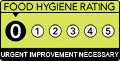 | ||
| 19 | Johal Dairies Ltd | Distance (miles) | 0.28 |
| Johal Dairies, Cannock Road, Springfield, Wolverhampton | | ||
| 20 | The Planet Night Club | Distance (miles) | 0.28 |
| The Planet, Westbury Street, Wolverhampton, West Midlands | | ||
| 21 | Medicine Bakery | Distance (miles) | 0.28 |
| Medicine, Chubb Buildings, Fryer Street, Wolverhampton | | ||
| 22 | Lockworks Cinema | Distance (miles) | 0.28 |
| Unit 5, Chubb Buildings, Fryer Street, Wolverhampton | | ||
| 23 | Samosa Boy | Distance (miles) | 0.29 |
| Westbury House, Westbury Street, Wolverhampton, West Midlands | | ||
| 24 | Afro Eat | Distance (miles) | 0.29 |
| Westbury House, Westbury Street, Wolverhampton, West Midlands | | ||
| 25 | Big Dee | Distance (miles) | 0.29 |
| The Prince Albert Public House, Railway Street, City Centre, Wolverhampton |  | ||
| 26 | Prince Albert | Distance (miles) | 0.29 |
| The Prince Albert Public House, Railway Street, City Centre, Wolverhampton |  | ||
| 27 | Chai Hubb | Distance (miles) | 0.31 |
| Chai Hub, 21 Broad Street, City Centre, Wolverhampton | | ||
| 28 | Camesas | Distance (miles) | 0.31 |
| 25 Broad Street, City Centre, Wolverhampton, West Midlands |  | ||
| 29 | Salsa Grill | Distance (miles) | 0.31 |
| 27 Broad Street, City Centre, Wolverhampton, West Midlands | | ||
| 30 | Chicky Chicken | Distance (miles) | 0.31 |
| Big Chicken, 23 Broad Street, City Centre, Wolverhampton | | ||
| 31 | Dixy Chicken Wolverhampton | Distance (miles) | 0.31 |
| Dixy Chicken, 29 Broad Street, City Centre, Wolverhampton | | ||
| 32 | Chickaros | Distance (miles) | 0.32 |
| 24 Broad Street, City Centre, Wolverhampton, West Midlands | | ||
| 33 | Drinks2Go | Distance (miles) | 0.32 |
| 31 Thornley Street, Wolverhampton, West Midlands | | ||
| 34 | Sainsbury's | Distance (miles) | 0.32 |
| Sainsburys Supermarkets Ltd, 7 Victoria Square, Wolverhampton, West Midlands | | ||
| 35 | Kismet Coffee | Distance (miles) | 0.32 |
| 10 Victoria Square, Wolverhampton, West Midlands | | ||
| 36 | Sunbeam | Distance (miles) | 0.32 |
| The Sunbeam, 11 Victoria Square, Wolverhampton, West Midlands | | ||
| 37 | SUPERDRUG | Distance (miles) | 0.32 |
| 9 Victoria Square, Wolverhampton, West Midlands | | ||
| 38 | SS News | Distance (miles) | 0.33 |
| 26 Broad Street, City Centre, Wolverhampton, West Midlands | | ||
| 39 | Kebab Rush | Distance (miles) | 0.33 |
| 28 Broad Street, City Centre, Wolverhampton, West Midlands | | ||
| 40 | Broad street convenience store | Distance (miles) | 0.33 |
| 18 Broad Street, City Centre, Wolverhampton, West Midlands | | ||
| 41 | Sanis Wolverhampton | Distance (miles) | 0.33 |
| 20 Broad Street, City Centre, Wolverhampton, West Midlands | | ||
| 42 | Peppers | Distance (miles) | 0.33 |
| 14 Broad Street, City Centre, Wolverhampton, West Midlands | | ||
| 43 | Aunt Sally's | Distance (miles) | 0.33 |
| Aunt Sallys, 8 Broad Street, City Centre, Wolverhampton | | ||
| 44 | One Stop Wolverhampton | Distance (miles) | 0.33 |
| One Stop, 174 Stafford Street, Whitmore Reans, Wolverhampton | | ||
| 45 | Phat Buns | Distance (miles) | 0.33 |
| 167 - 170 Stafford Street, Whitmore Reans, Wolverhampton, West Midlands | | ||
| 46 | Hogshead | Distance (miles) | 0.33 |
| Hogshead Public House, 185 - 186 Stafford Street, Whitmore Reans, Wolverhampton | | ||
| 47 | Fire Feast | Distance (miles) | 0.33 |
| 180 Stafford Court, Stafford Street, Whitmore Reans, Wolverhampton | | ||
| 48 | Hitokyo | Distance (miles) | 0.33 |
| 175 Stafford Street, Whitmore Reans, Wolverhampton, West Midlands | | ||
| 49 | Central Community Shop & Pomegranate Cafe | Distance (miles) | 0.34 |
| 1 - 2 Queens Building, Victoria Square, Wolverhampton, West Midlands | | ||
| 50 | Twelve | Distance (miles) | 0.34 |
| Broad Street, City Centre, Wolverhampton, West Midlands | | ||