 Eatible
Pub - Bar - Nightclub
Food Hygiene Rating for The Hunters Moon
birminham.jpg
The Hunters Moon is a pub.
The Hunters Moon is located in the city of Birmingham.
Rating: 5 - Very GoodLast inspected: Thu 5 Jun 2025B36 8BEfhrs

Very Good
Location
Local authority
Inspection details
Food Hygiene & Safety Procedures
Very Good (0)
High standard of compliance with legal requirements and code of practice.
Structural Compliance
Very Good (0)
High standard of compliance with legal requirements and code of practice.
Confidence in Management
Very Good (0)
Good record of compliance. Satisfactory documented HACCP-based Food Safety Management System.
- Overall food hygiene rating
- 5 - Very Good
- Date of last inspection
- 5 June 2025
- FHRS ID
- 954550
- Business type
- Pub - Bar - Nightclub
- Business name
- The Hunters Moon
- Address
- 220 Coleshill Road, Hodge Hill, Birmingham
- Responsible local authority
- birmingham
Customer rating
Nobody has submitted a score yet. Why not be the first?

Reviews
All reviews are moderated before approval.
Be the first to review The Hunters Moon.
Nearby food hygiene ratings
| 1 | The Hunters Moon | Distance (miles) | 0.00 |
| 220 Coleshill Road, Hodge Hill, Birmingham | | ||
| 2 | Grandy's | Distance (miles) | 0.10 |
| 8A Chipperfield Road, Birmingham |  | ||
| 3 | B And A Offlicence (CLOSED NOW 1ST ) | Distance (miles) | 0.13 |
| 2 Ermington Crescent, Birmingham | | ||
| 4 | Lloyds Pharmacy | Distance (miles) | 0.13 |
| 6 Ermington Crescent, Birmingham | | ||
| 5 | Golden Kitchen Chinese Takeaway | Distance (miles) | 0.13 |
| 10 Ermington Crescent, Birmingham | | ||
| 6 | Friends Express | Distance (miles) | 0.14 |
| 130 Bucklands End Lane, Birmingham | | ||
| 7 | Little Scallywags Day Nursery | Distance (miles) | 0.14 |
| 34 Bucklands End Lane, Birmingham | | ||
| 8 | Perizinos | Distance (miles) | 0.15 |
| 30 Chipperfield Road, Birmingham | | ||
| 9 | One Stop | Distance (miles) | 0.15 |
| 32-36 Chipperfield Road, Birmingham |  | ||
| 10 | Colebourne Primary School | Distance (miles) | 0.15 |
| Stechford Road, Birmingham | | ||
| 11 | ABSAAR Your Local Meat and Grocery S | Distance (miles) | 0.15 |
| 28 Chipperfield Road, Birmingham |  | ||
| 12 | Clock Garage Ltd | Distance (miles) | 0.15 |
| Coleshill Road, Hodge Hill, Birmingham | | ||
| 13 | Atlantis Fish Bar | Distance (miles) | 0.16 |
| 117 Shawsdale Road, Birmingham |  | ||
| 14 | Pizza Perfect | Distance (miles) | 0.16 |
| 123 Shawsdale Road, Birmingham | | ||
| 15 | Elderlink | Distance (miles) | 0.16 |
| Hodge Hill Gospel Church, Bucklands End Lane, Birmingham | | ||
| 16 | Small Talk Nurseries | Distance (miles) | 0.17 |
| 125-129 Shawsdale Road, Birmingham | | ||
| 17 | El-Roi Foods | Distance (miles) | 0.19 |
| 143 Shawsdale Road, Birmingham | | ||
| 18 | Little Explorer's Nursery | Distance (miles) | 0.23 |
| 126 Bucklands End Lane, Birmingham | | ||
| 19 | Flying High Nursery | Distance (miles) | 0.25 |
| 322 Coleshill Road, Hodge Hill, Birmingham | | ||
| 20 | Your Local Pantry | Distance (miles) | 0.25 |
| Hodge Hill United Reformed Church, Coleshill Road, Hodge Hill, Birmingham | | ||
| 21 | The Raven | Distance (miles) | 0.26 |
| Hodge Hill Road, Birmingham | | ||
| 22 | FitzRoy Support | Distance (miles) | 0.27 |
| 227 Coleshill Road, Hodge Hill, Birmingham | | ||
| 23 | FitzRoy Support | Distance (miles) | 0.27 |
| 225 Coleshill Road, Hodge Hill, Birmingham | | ||
| 24 | Zam Zam /Hodge Hill Mini Market | Distance (miles) | 0.28 |
| Zam Zam /Hodge Hill Mini Market, 192 Maryland Avenue, Birmingham | | ||
| 25 | VF Clock Spar / Tango Blast | Distance (miles) | 0.30 |
| Clock Service Station, Coleshill Road, Hodge Hill, Birmingham | | ||
| 26 | Subway Clock | Distance (miles) | 0.30 |
| Clock Service Station, Coleshill Road, Hodge Hill, Birmingham | | ||
| 27 | Manna and Maple | Distance (miles) | 0.32 |
| 81 Millington Road, Birmingham | | ||
| 28 | One Stop | Distance (miles) | 0.33 |
| 194-196 Maryland Avenue, Birmingham | | ||
| 29 | Burger Shack - Hodgehill | Distance (miles) | 0.33 |
| 182 Maryland Avenue, Birmingham | | ||
| 30 | Hodge Hill Grange Care Home HC-One | Distance (miles) | 0.35 |
| Hodge Hill Grange, 150 Coleshill Road, Hodge Hill, Birmingham | | ||
| 31 | St Wilfrid's Community Centre | Distance (miles) | 0.35 |
| St Wilfreds Community Centre, Shawsdale Road, Birmingham | | ||
| 32 | The Common Room | Distance (miles) | 0.35 |
| Crofton Gardens, Birmingham | | ||
| 33 | St Wilfrid's Rc Jun/Inf School Out Of | Distance (miles) | 0.36 |
| St Wilfrids Rc Primary School, Shawsdale Road, Birmingham | | ||
| 34 | Spark Active | Distance (miles) | 0.36 |
| St Wilfrids Rc Primary School, Shawsdale Road, Birmingham | | ||
| 35 | St Wilfrids Rc Primary School | Distance (miles) | 0.36 |
| Shawsdale Road, Birmingham | | ||
| 36 | Firs Primary Academy | Distance (miles) | 0.39 |
| Firs Junior And Infant School, Dreghorn Road, Birmingham | | ||
| 37 | Lifestyle Express | Distance (miles) | 0.41 |
| 63-65 Collingbourne Avenue, Birmingham | | ||
| 38 | Collingbourne Day Nursery | Distance (miles) | 0.41 |
| 67 Collingbourne Avenue, Birmingham |  | ||
| 39 | Comet Public House | Distance (miles) | 0.41 |
| 1 Collingbourne Avenue, Birmingham | | ||
| 40 | Chicken N Slice | Distance (miles) | 0.42 |
| 61 Collingbourne Avenue, Birmingham | | ||
| 41 | KINGFISHER | Distance (miles) | 0.48 |
| The Heathway, Heathland Avenue, Birmingham | 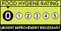 | ||
| 42 | Heathway Spice | Distance (miles) | 0.49 |
| Heathway Public House, Parent For Commercial Premises And Flat, Heathland Avenue, Birmingham | | ||
| 43 | Heron Foods | Distance (miles) | 0.49 |
| Unit 1, The Heathway, Heathland Avenue, Birmingham | | ||
| 44 | Heathway Pizza | Distance (miles) | 0.49 |
| Heathway Public House, Parent For Commercial Premises And Flat, Heathland Avenue, Birmingham | | ||
| 45 | Heathland Balti Limited T/A Heathway Spice | Distance (miles) | 0.49 |
| Heathway Public House, Parent For Commercial Premises And Flat, Heathland Avenue, Birmingham | | ||
| 46 | The Heathway Pub Ltd | Distance (miles) | 0.49 |
| Heathway Public House, Parent For Commercial Premises And Flat, Heathland Avenue, Birmingham | | ||
| 47 | Bugsy's Bakery | Distance (miles) | 0.51 |
| 205 Heath Way, Shard End, Birmingham | | ||
| 48 | Post Office | Distance (miles) | 0.52 |
| 209 Heath Way, Shard End, Birmingham | | ||
| 49 | New Seaway Fish Shop | Distance (miles) | 0.52 |
| 195 Heath Way, Shard End, Birmingham | | ||
| 50 | Shard End Balti | Distance (miles) | 0.52 |
| 223 Heath Way, Shard End, Birmingham | | ||