 Eatible
Restaurant - Cafe - Canteen
Food Hygiene Rating for Sahara Sands
Sahara Sands is located in the city of Southampton.
Rating: AwaitingInspectionSO18 2BBfhrs

Location
Local authority
Inspection details
Food Hygiene & Safety Procedures
Very Good (0)
High standard of compliance with legal requirements and code of practice.
Structural Compliance
Very Good (0)
High standard of compliance with legal requirements and code of practice.
Confidence in Management
Very Good (0)
Good record of compliance. Satisfactory documented HACCP-based Food Safety Management System.
- Overall food hygiene rating
- AwaitingInspection
- Date of last inspection
- Not available
- FHRS ID
- 1683246
- Business type
- Restaurant - Cafe - Canteen
- Business name
- Sahara Sands
- Address
- 26 Litchfield Road, Southampton
- Responsible local authority
- southampton
Customer rating
Nobody has submitted a score yet. Why not be the first?

Reviews
All reviews are moderated before approval.
Be the first to review Sahara Sands.
Nearby food hygiene ratings
| 1 | Sahara Sands | Distance (miles) | 0.00 |
| 26 Litchfield Road, Southampton | | ||
| 2 | Tops Pizza - Southampton SO18 | Distance (miles) | 0.13 |
| 8 Midanbury Broadway, Witts Hill, Southampton | | ||
| 3 | MIKES CHIPPY | Distance (miles) | 0.13 |
| 5 Midanbury Broadway, Witts Hill, Southampton |  | ||
| 4 | Witts Hill Supermarket | Distance (miles) | 0.13 |
| 1 Midanbury Broadway, Witts Hill, Southampton |  | ||
| 5 | New Oriental | Distance (miles) | 0.13 |
| 3 Midanbury Broadway, Witts Hill, Southampton | 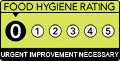 | ||
| 6 | 7 Hills Kebab | Distance (miles) | 0.13 |
| 4 Midanbury Broadway, Witts Hill, Southampton | | ||
| 7 | TESCO EXPRESS | Distance (miles) | 0.13 |
| Witts Hill, Southampton | | ||
| 8 | The Mulberry Bush | Distance (miles) | 0.14 |
| Witts Hill, Southampton | | ||
| 9 | LONDIS | Distance (miles) | 0.24 |
| 117 Meggeson Avenue, Southampton | | ||
| 10 | Alpine News and Food | Distance (miles) | 0.26 |
| 1 Vanguard Road, Southampton | | ||
| 11 | Cupcake Toppers Ltd | Distance (miles) | 0.27 |
| 35 Meggeson Avenue, Southampton | | ||
| 12 | Life-Link Church Over Sixties Community Group | Distance (miles) | 0.29 |
| Townhill Park Community Centre, Meggeson Avenue, Southampton | | ||
| 13 | City Life Church | Distance (miles) | 0.29 |
| Townhill Park Community Centre, Meggeson Avenue, Southampton | | ||
| 14 | Townhill Infant School | Distance (miles) | 0.29 |
| Benhams Road, Southampton | | ||
| 15 | Townhill Junior School | Distance (miles) | 0.29 |
| Benhams Road, Southampton | | ||
| 16 | Squirrels Corner Pre-School | Distance (miles) | 0.36 |
| Moorlands Community Centre, Townhill Way, Southampton | | ||
| 17 | Bitterne Park School | Distance (miles) | 0.37 |
| 1 Copsewood Road, Southampton | | ||
| 18 | Gregg School | Distance (miles) | 0.37 |
| Gregg School, Cutbush Lane, Southampton | | ||
| 19 | Shanghai Garden | Distance (miles) | 0.44 |
| 4 Premier Parade, Forest Hills Drive, Southampton | | ||
| 20 | SAI Arrow News | Distance (miles) | 0.44 |
| 1 Premier Parade, Forest Hills Drive, Southampton |  | ||
| 21 | Darchini | Distance (miles) | 0.44 |
| 2 Premier Parade, Forest Hills Drive, Southampton | | ||
| 22 | SIZZLE | Distance (miles) | 0.45 |
| 9 Premier Parade, Forest Hills Drive, Southampton | | ||
| 23 | Moorlands Primary School | Distance (miles) | 0.45 |
| Kesteven Way, Southampton | | ||
| 24 | Arty-Stan Pizza (also T/As Arty-Stan Events Ltd) | Distance (miles) | 0.51 |
| 130 Edelvale Road, Southampton | | ||
| 25 | Yarrow Heights School | Distance (miles) | 0.51 |
| Cobden Avenue, Southampton | | ||
| 26 | Morrisons Daily | Distance (miles) | 0.52 |
| 134 West End Road, Southampton | | ||
| 27 | Oaktree Road Post Office and Store | Distance (miles) | 0.52 |
| 157-159 Oaktree Road, Southampton | | ||
| 28 | TESCO EXPRESS | Distance (miles) | 0.53 |
| 149 - 153 West End Road, Southampton | | ||
| 29 | The Hop Inn | Distance (miles) | 0.54 |
| 199 Woodmill Lane, Southampton | | ||
| 30 | The Coffee Shop Cafe | Distance (miles) | 0.55 |
| 1B Hatley Road, Southampton | | ||
| 31 | TWO BROTHERS | Distance (miles) | 0.55 |
| THE TWO BROTHERS TOWNHILL FARM DISTRICT CENTRE WESSEX ROAD WEST END SOUTHAMPTON SO18 3RA | | ||
| 32 | St Catherines Rest Home | Distance (miles) | 0.55 |
| 19-21 St. Catherines Road, Southampton | | ||
| 33 | JEWELS RESTAURANT | Distance (miles) | 0.57 |
| UNIT 2 AND 3 TOWNHILL FARM DISTRICT CENTRE WESSEX ROAD WEST END SOUTHAMPTON SO18 3RA | | ||
| 34 | TESCO EXPRESS | Distance (miles) | 0.57 |
| 1 TOWNHILL FARM DISTRICT CENTRE WESSEX ROAD WEST END SOUTHAMPTON SO18 3RA | | ||
| 35 | Hong Kong Chef | Distance (miles) | 0.57 |
| 7 TOWNHILL FARM DISTRICT CENTRE WESSEX ROAD WEST END SOUTHAMPTON SO18 3RA | | ||
| 36 | CHARTWELL PHARMACY | Distance (miles) | 0.57 |
| 4 TOWNHILL FARM DISTRICT CENTRE WESSEX ROAD WEST END SOUTHAMPTON SO18 3RA |  | ||
| 37 | Earlystarts Childcare | Distance (miles) | 0.57 |
| Charlton House Prep School, 57 Midanbury Lane, Southampton | | ||
| 38 | B P After School Club | Distance (miles) | 0.58 |
| 49 Oaktree Road, Southampton | | ||
| 39 | Soca Shack | Distance (miles) | 0.59 |
| 33 Manor Farm Road, Southampton | | ||
| 40 | Life-Link Church Over 60's Group | Distance (miles) | 0.60 |
| COMMUNITY CENTRE TOWNHILL FARM DISTRICT CENTRE WESSEX ROAD WEST END SOUTHAMPTON SO18 3RA | | ||
| 41 | Townhill Farm Community Centre | Distance (miles) | 0.60 |
| COMMUNITY CENTRE TOWNHILL FARM DISTRICT CENTRE WESSEX ROAD WEST END SOUTHAMPTON SO18 3RA | | ||
| 42 | Plested Bakehouse | Distance (miles) | 0.60 |
| 21 Manor Farm Road, Southampton | | ||
| 43 | SNA Express | Distance (miles) | 0.61 |
| 11 Manor Farm Road, Bitterne Park, Southampton |  | ||
| 44 | Miss Ellie's | Distance (miles) | 0.61 |
| 31A Manor Farm Road, Southampton | | ||
| 45 | Bengal Paradise | Distance (miles) | 0.61 |
| 3 Manor Farm Road, Bitterne Park, Southampton | | ||
| 46 | Curry Lounge | Distance (miles) | 0.61 |
| 9 Manor Farm Road, Southampton | | ||
| 47 | Butcher's Hook Alehouse | Distance (miles) | 0.61 |
| 7 Manor Farm Road, Southampton | | ||
| 48 | The Songbird Icecream Cafe | Distance (miles) | 0.61 |
| 23 Manor Farm Road, Southampton | | ||
| 49 | SPAR | Distance (miles) | 0.61 |
| 17 Manor Farm Road, Southampton | | ||
| 50 | Chip Stop | Distance (miles) | 0.61 |
| 8 TOWNHILL FARM DISTRICT CENTRE WESSEX ROAD WEST END SOUTHAMPTON SO18 3RA | | ||