 Eatible
Pub - Bar - Nightclub
Food Hygiene Rating for The Kings Head
Mid Suffolk.jpg
The Kings Head is a pub.
The Kings Head is located in the village of Mendlesham.
Rating: 0 - Urgent Improvement NecessaryLast inspected: Fri 6 Feb 2026IP14 5SAfhrs
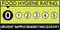
Urgent Improvement Necessary
Location
Address
The Kings Head. The Kings Head, Old Market Street, Mendlesham, STOWMARKET
Mendlesham STOWMARKET IP14Local authority
Inspection details
Food Hygiene & Safety Procedures
Improvement Necessary (15)
Some major non-compliance with legal requirements. More effort required to prevent a fall in standards.
Structural Compliance
Major Improvement Necessary (20)
General failure to satisfy legal requirements. Standards generally low.
Confidence in Management
Major Improvement Necessary (20)
Varying record of compliance. Poor appreciation of hazards and control measures. No Food Safety Management System.
- Overall food hygiene rating
- 0 - Urgent Improvement Necessary
- Date of last inspection
- 6 February 2026
- FHRS ID
- 1404505
- Business type
- Pub - Bar - Nightclub
- Business name
- The Kings Head
- Address
- The Kings Head. The Kings Head, Old Market Street, Mendlesham, STOWMARKET
- Responsible local authority
- mid-suffolk
Customer rating
Nobody has submitted a score yet. Why not be the first?

Reviews
All reviews are moderated before approval.
Be the first to review The Kings Head.
Nearby food hygiene ratings
| 1 | The Kings Head | Distance (miles) | 0.00 |
| The Kings Head. The Kings Head, Old Market Street, Mendlesham, STOWMARKET | | ||
| 2 | Mendlesham Community Cafe | Distance (miles) | 0.02 |
| 2 Old Market Street, Mendlesham, STOWMARKET, Suffolk |  | ||
| 3 | Mrs Portly's Kitchen | Distance (miles) | 1.05 |
| Bridge House, The Street, Wetheringsett cum Brockford, STOWMARKET | | ||
| 4 | Brockford Garage | Distance (miles) | 1.18 |
| Brockford Service Station Brockford Garage, Norwich Road, Thwaite, EYE | | ||
| 5 | Landguard Fort Trust | Distance (miles) | 1.34 |
| Landguard Fort, View Point Road, Felixstowe, Suffolk | | ||
| 6 | Beccles Methodist And United Reformed Church | Distance (miles) | 1.34 |
| Methodist Reform Church, Hungate, Beccles, Suffolk | | ||
| 7 | Larder On The Hill | Distance (miles) | 1.34 |
| Bloodmoor Hill Community Centre, Dale End, Gisleham, Suffolk | | ||
| 8 | Gun Hill Beach Cafe | Distance (miles) | 1.34 |
| Promenade, Southwold, Suffolk | | ||
| 9 | Harbour Inn | Distance (miles) | 1.34 |
| The Harbour Inn, Blackshore, Southwold, Suffolk | | ||
| 10 | Southwold Sailing Club | Distance (miles) | 1.34 |
| Blackshore, Southwold, Suffolk | | ||
| 11 | Waveney House Hotel | Distance (miles) | 1.34 |
| Puddingmoor, Beccles, Suffolk | | ||
| 12 | All Saints Church Hall | Distance (miles) | 1.34 |
| Main Road, Kesgrave, Suffolk | | ||
| 13 | Vertas At Orford CEVAP School | Distance (miles) | 1.34 |
| Orford Primary School, School Lane, Orford, Suffolk | | ||
| 14 | Ferry Cafe | Distance (miles) | 1.34 |
| The Ferry, Felixstowe, Suffolk |  | ||
| 15 | Libardis Coffee | Distance (miles) | 1.34 |
| Tea Kiosk, Crag Path, Aldeburgh, Suffolk | | ||
| 16 | Felixstowe Museum | Distance (miles) | 1.34 |
| Landguard Fort, View Point Road, Felixstowe, Suffolk |  | ||
| 17 | Ferry Boat Inn | Distance (miles) | 1.34 |
| The Ferry, Felixstowe, Suffolk |  | ||
| 18 | Lunch Club | Distance (miles) | 2.18 |
| Wickham Skeith Village Hall, The Green, Wickham Skeith, EYE | | ||
| 19 | Ellis Famliy Flock | Distance (miles) | 2.51 |
| Ellis Family Flock Whitehouse Farm, Whitehouse Lane, Earl Stonham, STOWMARKET | | ||
| 20 | The Mayor's Parlour | Distance (miles) | 2.63 |
| Town Hall, Cornhill, Ipswich, Suffolk | | ||
| 21 | Town Farm Barn | Distance (miles) | 2.86 |
| Leylands Farm, Middlewood Green, Earl Stonham, STOWMARKET | | ||
| 22 | W & M Smith | Distance (miles) | 2.94 |
| W+M Smith Florist Supplies Pightle Barn, Blacksmiths Lane, Earl Stonham, STOWMARKET | | ||